Donate
See how you can support the trust
Climate change

'Painting with Fire': Cutting-edge bushfire management

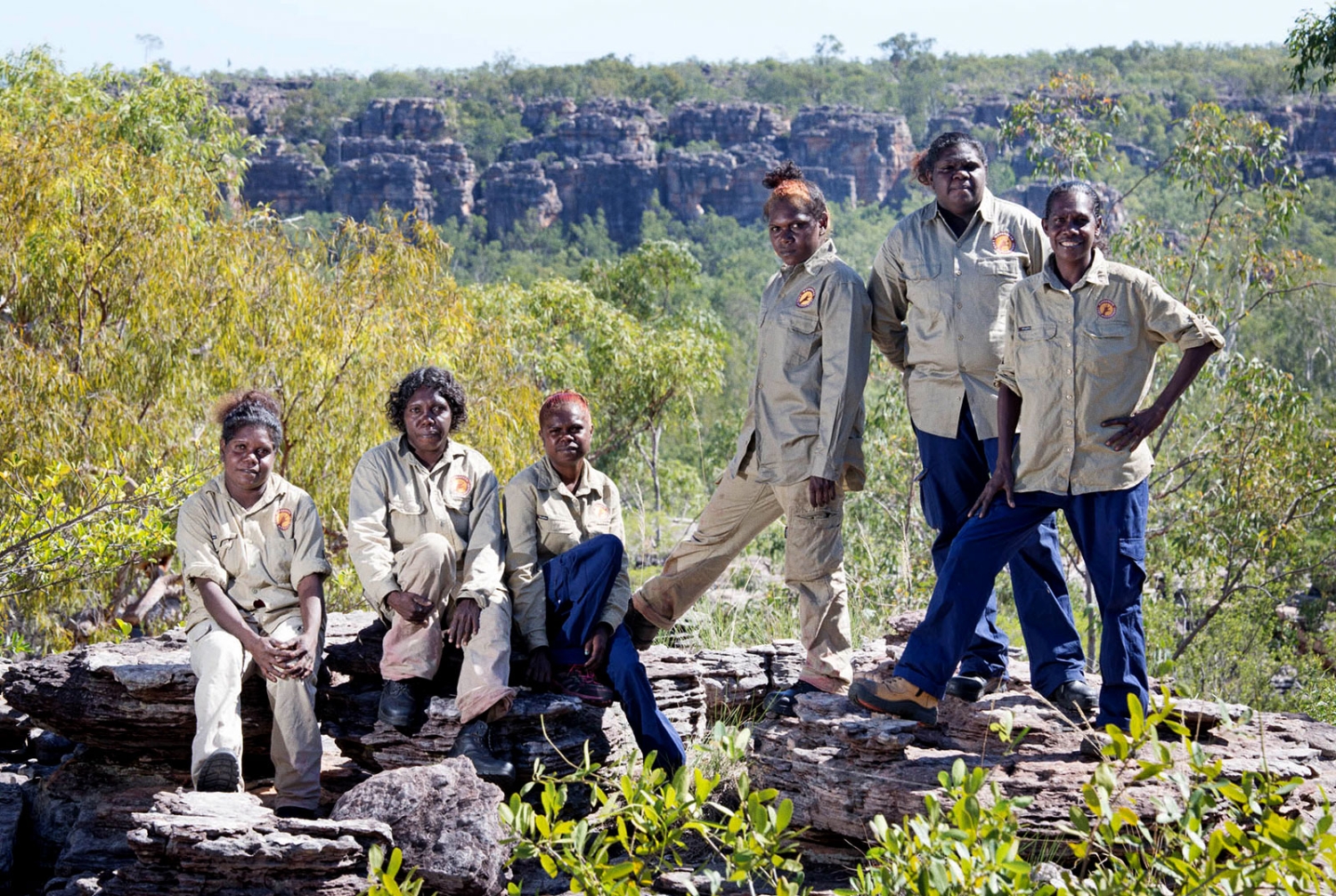
"We use fire for many reasons: not only for conservation and management, but also as a healing process for land, for people, for native plants and animals. Fire is a tool that we have used from the beginning, from the deep past until today." - Dean Yibarbuk, Traditional Owner of Djinkarr and Co-Chair of KKT

May 22nd, 2023
Arnhem Land
Arnhem Land Fire Abatement (NT) Limited

One of KKT's partner organisations is Arnhem Land Fire Abatement (ALFA) NT, which manages the engagement of Arnhem Land's Indigenous ranger groups with the carbon market. These activities, conducted annually, generate an independent source of income for rangers through the sale of carbon credits. In May 2023, The Conversation ran an article about this work which called it "one of the world’s best bushfire management programs". You can read the article below.

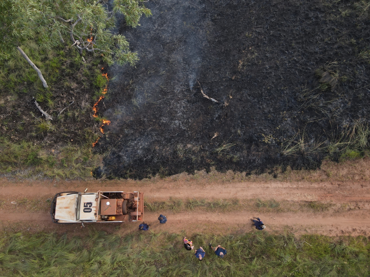
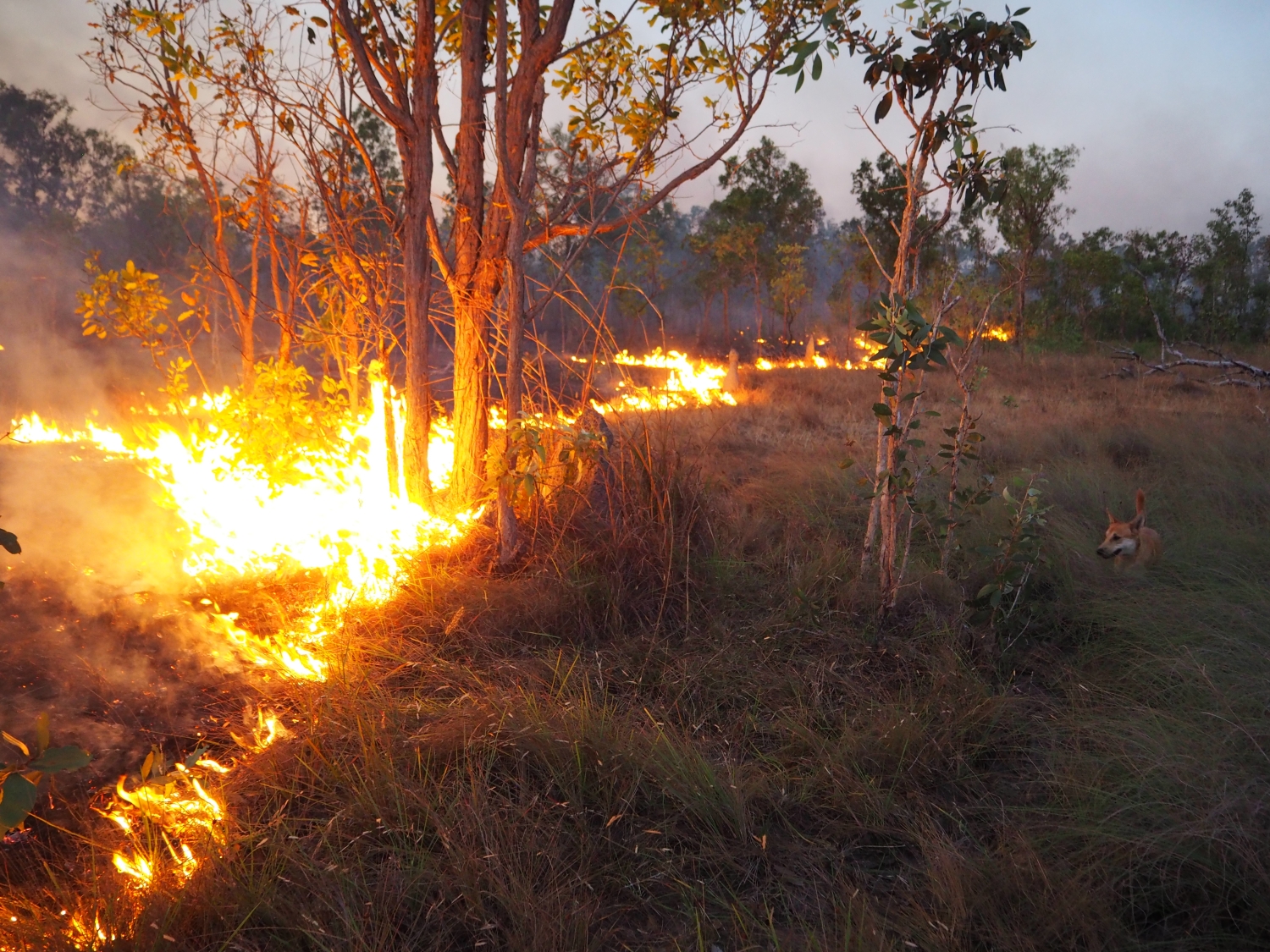
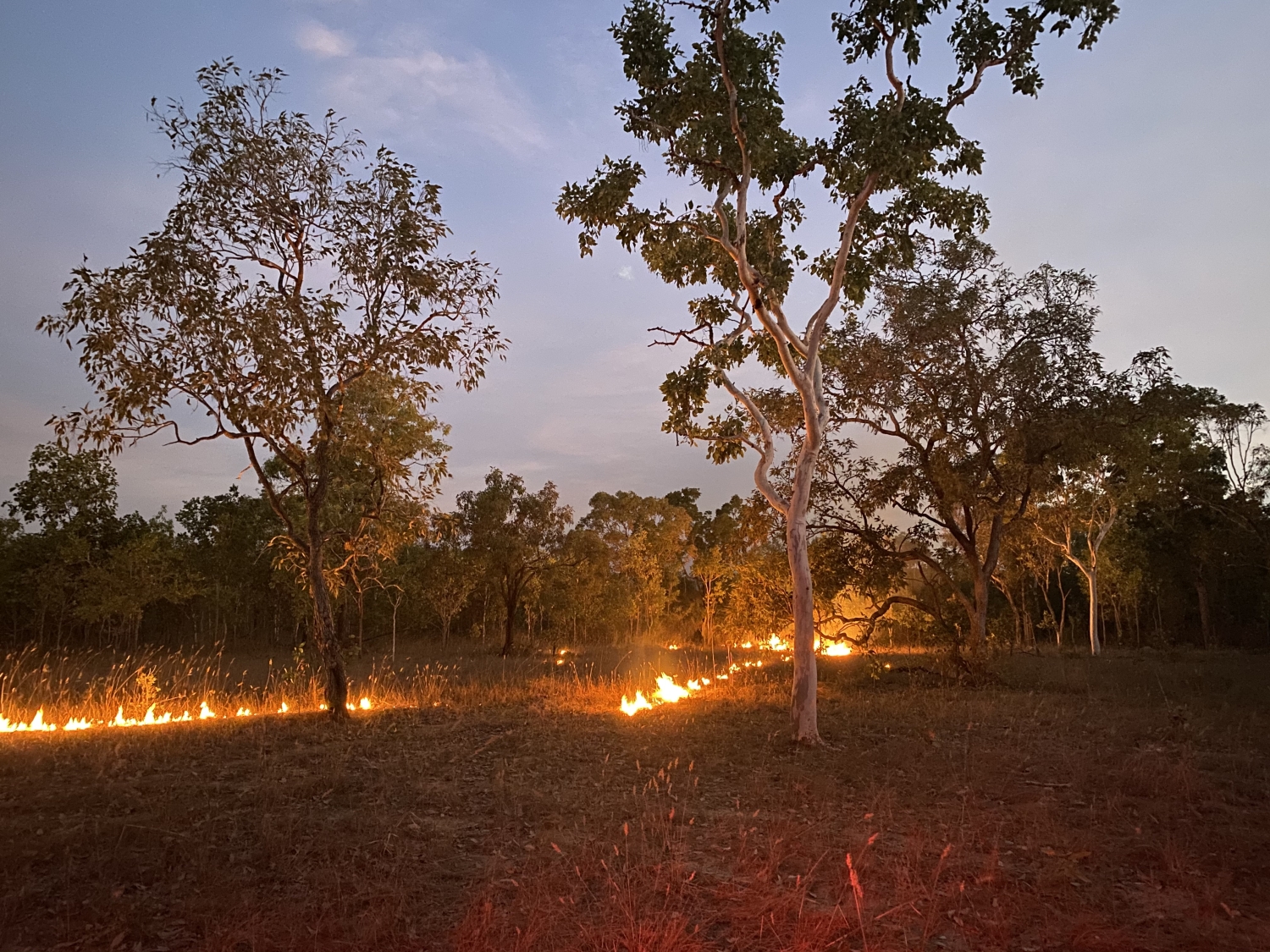
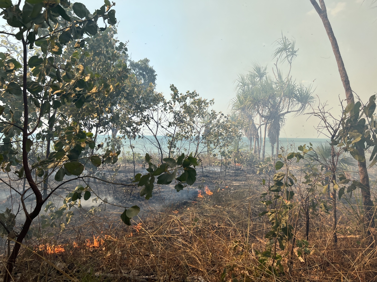
‘Right now, hundreds of bushfires are burning across northern Australia. But this is not a wildfire catastrophe—in fact, these burns are making things safer in one of the most fire-prone landscapes in the world. From April to June each year, fire managers—such as Traditional Owners, park rangers and pastoralists—aim to create small, “cool” fires with care and precision to reduce fuel loads before conditions get severe later in the dry season. This work, “painting” landscapes with fire, is constantly informed by satellite data.

'The combination of space technology with Indigenous knowledge and the know-how of pastoralists and park rangers has been everyday practice across northern Australia for the past 20 years. Not only does this work produce some of the best fire management outcomes in the world, it also demonstrates how cutting-edge technology can inform local and traditional knowledge for environmental management...

'In the early 2000s, researchers and land managers brought together by the Cooperative Research Centre for the Sustainable Development of Tropical Savannahs realised satellite imagery could be of great help for fire management across Australia’s vast tropical savannas.

Read on here.

Related posts
Stay updated.
Subscribe for our latest news.
Success!